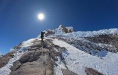
Trombacci - Punta Campanella (Sorrento Massa Lubrense)
Descrizione
L1 : 5a L2 : 6a L3 : 6b Dalla grotta in basso al livello del mare (c.d. del sale) parte una gola dove traversare fino alla mini-tirolese. La via attacca a destra di ragno di mare. DESCRIZIONE DELLA VIA Via poco interessante se non per l'ultimo tiro che si consiglia di abbinare a ragno di mare
Accesso
Si lascia la piazza di Termini seguendo i segni gialli e dopo circa 200m si lascia la strada che continua diritta verso Monte San Costanzo e si comincia a scendere.
Fino alla Punta non c'è praticamente possibilità di sbagliare strada: si segue la stradina principale (il cui stato peggiora man mano che ci si allontana da Termini) lasciando a sinistra via Cercito e poi a destra via Mitigliano.
Dopo questo secondo incrocio si continua a scendere fino a Cancello (passaggio fra il costone ed un pinnacolo roccia). Prima di attraversare questo "ingresso", se effettuate l'escursione fra gennaio e marzo, vedrete in alto a sinistra i bellissimi fiori "blu elettrico" della Lithodora rosmarinifolia, pianta endemica della Penisola Sorrentina e Capri.
Dopo varie centinaia di metri praticamente in piano, fra uliveti, c'è una piccola piazzola sulla destra dalla quale si gode di un'ottima vista sulla Torre di Fossa di Papa (recentemente restaurata) e su Capri. Da questo punto in poi la stradina diventa ancora più stretta e dissestata e dopo poco comincia la discesa finale alla Punta della Campanella.
Prima di raggiungere lo slargo che sovrasta la Torre Minerva (o della Campanella) c'è un sentiero a sinistra che ci conduce in una gola, percorrerla interamente fino ad individuare sulla destra i primi fittoni di "fenomeno osmotico" e affacciandosi alla destra il resto del settore "Umberto Iorio"
Materiale
12 rinvii e una corda da 70m
Discesa
alla fine della via lungo il sentiero
Esposizione:
Sud - Est
Chiodatura
Adriano Trombetta , Cristiano Bacci
Chi riconoscere l’indispensabile lavoro svolto dai chiodatori?
Un opera resa ancor piu nobile e preziosa dalla sua natura quasi sempre gratuita e volontaria.
Se oggi si puo scalare con ampi margini di sicurezza in tutta Italia, lo si deve quasi esclusivamente al lavoro di questi volontari.
Chiunque può dare il suo contributo anche con un euro
Tipo Roccia:
calcare bianco
- Falesia: Punta Campanella (Sorrento Massa Lubrense)
-
Sezione: campaniacampania
- Difficoltà: s1 6b+ max , 6a obb
- Altezza: 0-70 / 70 m
- Data Apertura:
- Bellezza:
-
Latitudine:
Longitudine:N 40.5696º
E 14.3254º
-
Latitudine:
Longitudine:N 40.5818º
E 14.3268º
Tipo: placca compatta
Logistica: Sentiero a tratti esposto, Mini-tirolese per l'accesso al traverso
- Aggiornato: 17/06/2014
- Letture: 45430


